
Where Precision Shaped Power
In the rolling hills of the Roman countryside, a group of men stand motionless, peering through cross-shaped instruments. One marks the earth with a rod while another calls out numbers, scribbled quickly onto a wax tablet. These are the agrimensores—Roman land surveyors of the 1st century AD—quiet engineers of order, whose work mapped and measured the very shape of the empire.
The Origins of Roman Land Surveying
The profession of agrimensor (from ager, field, and mensura, measure) dates back to the Republic but was elevated under the Empire as land division became critical for military settlements, agricultural planning, and taxation. Agrimensores were specialists trained in mathematics, geometry, and topography.
They often accompanied colonists, soldiers, and administrators to newly conquered territories—measuring, dividing, and recording land with precision and legal authority.
Tools of the Trade
Roman surveyors used a suite of ingeniously simple but effective tools:
- Groma: A cross-shaped instrument mounted on a vertical pole, used to establish straight lines and right angles
- Measuring rods (decempeda): Ten-foot wooden rods for linear measurements
- Chorobates: A leveling instrument for horizontal alignment, used in aqueduct construction
- Dioptra: An early theodolite for angular measurements (used mainly by advanced technicians)
- Wax tablets and styluses for field notation
These tools enabled agrimensores to create accurate, rectangular land plots known as centuriae, typically 20 by 20 actus (roughly 710 by 710 meters).
The Land Division System: Centuriation
Perhaps the most lasting legacy of Roman surveying was centuriation—the systematic division of land into a grid-like pattern. This was especially common in the establishment of new colonies (coloniae) or during the redistribution of confiscated lands.
Each centuria was allocated to settlers, veterans, or leased out, with borders marked by:
- Boundary stones (termini), sacred and legally binding
- Roads and irrigation canals, often aligned with the grid
- Public records—kept in provincial and central archives
Remnants of this system are still visible in aerial photography of Italian, French, and North African landscapes.
Legal and Social Role
Agrimensors were more than technicians—they were legal authorities. Their surveys resolved disputes, authenticated property claims, and provided the basis for taxation. In some cases, they acted as expert witnesses in land trials.
Their writings—compiled in the Corpus Agrimensorum Romanorum—combined technical knowledge, jurisprudence, and commentary, reflecting their complex role in Roman society.
Training and Status
Agrimensors were educated in mathematics, geometry, and law, often through apprenticeships or state-sponsored academies. While many were freedmen or professionals outside the senatorial elite, they commanded respect for their expertise.
In military contexts, they were attached to legions and tasked with camp layout, road planning, and fortification mapping. Their skill in logistical precision made expansion possible.
Surveying in Public Works
Beyond agriculture and land division, agrimensores played critical roles in public infrastructure projects:
- Aqueducts—Ensuring consistent gradient and alignment
- Roads—Laying straight, efficient paths between cities and forts
- Urban planning—Plotting streets, property lines, and forum layouts
Roman engineers like Vitruvius emphasized the importance of surveying in architecture and engineering, cementing its role in imperial design.
Conflict and Disputes
Land disputes were common, especially in frontier provinces or areas with unclear boundaries. Surveyors were called upon to verify maps, remeasure plots, and determine rightful ownership. Their impartiality was essential, though at times contested—some were accused of favoritism or corruption.
The sacredness of the terminus stone reflects the seriousness with which Romans viewed land boundaries. Tampering with them was both a civil crime and religious offense.
Legacy and Influence
Roman surveying principles endured well beyond the fall of the Empire. Medieval land records often relied on Roman grids, and Renaissance cartographers reawakened interest in the Corpus Agrimensorum. Modern cadastral systems and land registry owe much to Roman techniques and legal frameworks.
Mapping the World, One Plot at a Time
As Rome conquered new lands, it imposed not only laws and roads but geometry and order. The agrimensores, with their gromas and rods, quietly reshaped landscapes into legible, taxable, cultivable space. They didn’t carry swords, but their lines and angles cut deeper and lasted longer—imposing Roman vision onto the earth itself.
Related posts:
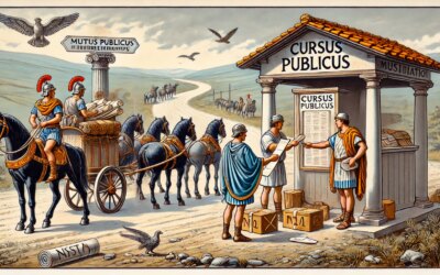 Cursus Publicus: The Roman Postal System That Connected an Empire
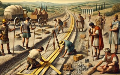 Paving the Empire: The Engineering Genius Behind Roman Roads in the 1st Century BCE
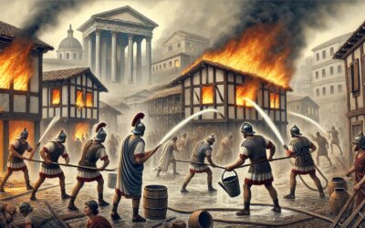 Fighting Flames in the Eternal City: Roman Fire Brigades in the 1st Century AD
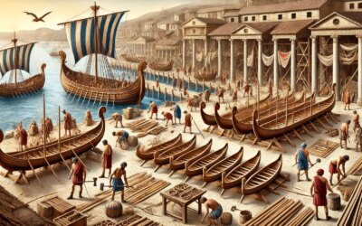 Building Rome’s Naval Might: Inside a Roman Shipyard in the 1st Century AD